Karya I Made Andi Arsana, ST., ME Batas Maritim Antarnegara - Sebuah Tinjauan Teknis dan Yuridis (Gadjah Mada University Press, 2007) more...

Tuesday, August 07, 2007

Toponymy and Extented Continental Shelf: Sovereignty and Sovereign Rights

Kompas (24 July 2007) covered an interesting news regarding the intention of Indonesian government to register thousands of its islands to the United Nations. It was said that Indonesian government is ready for a submission to the UN after verifying at least 3,046 islands in 11 provinces. The verification also includes the activities to name thousands of previously nameless islands across the archipelago. This month, it is targeted that all islands in Indonesia's 15 provinces can be registered to the UN and the project that started in 2005 is expected to finish this year.

For the laymen in this country, it has been long believed that Indonesia has more than 17 thousands island from Sabang to Merauke (west-east) and From Rote to Miangas (south-north). A –so called- official sources states that there are precisely 17,504 islands in the archipelago. If the data is correct and has gained recognition from the international community including the UN, why would Indonesia need to register their island? If it is true that island naming was the project, didn’t they have name before? This should be very interesting.

Yes, it has to be admitted that we have not yet had names for every single island that we claim to be part of Indonesia. An official states that there are more than 9000 nameless islands in Indonesia and has to be named before registration to the UN (The Jakarta Post, June 11, 2007). This is the fact and this is what we are currently doing. Toponymy is the term for island naming and it involves certain steps and procedures as endorsed by the United Nations Group of Experts on Geographical Names (UNGEGN). The twenty-fourth Session will be done in New York on 20 and 31 August 2007 and therefore Indonesia has to submit list of island names beforehand.

Article 121 of the United Nations Conventions on the Law of the Sea 1982 (UNCLOS), which Indonesia is a party to, provides the definition of islands. In order to be recognized as an island, a feature in the sea has to meet several criteria such as naturally formed, always appear on the surface of the sea even during high tide, and it has to have capacity to sustain human habitation. Surprisingly, as highlighter by Alex SW Retraubun (Department of Ocean Affairs and Fisheries), around three thousand islands proposed by local government did not meet these criteria in verification. This mean that the numbers of islands in Indonesia could be less than that we used to believe.

Notwithstanding the number of the islands, naming the unnamed islands for Indonesia is really strategic. This is considered as the first important step in realizing the intension for developing and maintaining small islands. While it is important for economic development, the more significant impact is to the national sovereignty. It has been evident that this country has been facing many problems concerning sovereignty and sovereign rights. What the government has done to those islands seem to be a very good response. This is an addition to the President Decree concerning the management and developments of small outer islands in Indonesia (PP No 78/2005).

Thu Indonesia’s outer islands play important roles regarding Indonesia’s territorial waters and maritime boundaries with neighboring States. On many of those islands, basepoints of Indonesian baseline were placed. Baseline is the line from which maritime jurisdictions (territorial sea, exclusive economic zones, and continental shelf) are measured. This means that the existence of the small outer islands is vital. This is the forward point from which our maritime claim is measured and maritime boundaries with our neighbors may be constructed. Simply speaking, the toponymic activity (especially for the small outer islands) contributes significantly to the Indonesian economic development, sovereignty, and sovereign rights.

With regard to sovereignty and sovereign rights, it seems that there are tendencies where coastal States intent to claim more and more maritime area. Russia, for example, is currently conducting an expedition to the North Pole to claim the no man’s land. Around 50 scientists were sent off to the North Pole and they plan to place a titanium capsule on the North Pole’s seabed with a Russian Flag in it. This will be an evidence of Russia’s claim over. Similarly, Australia declared its claim over continental shelf in 2004 encompassing the seabed area in the Antarctic. This is another indication that there are “creeping jurisdictions of coastal States”. Is there any legal basis for their maneuver?

What Russia is doing sparks controversy all over the globe. However, there is legal reason for the movement. It is the UNCLOS that enables coastal States to claim continental shelf beyond 200 nautical miles (M), which is also called extended continental shelf (ECS). Being State parties to the UNCLOS, Russia and Australia have the chance to submit their claim over ECS to the Commission on the Limits of Continental Shelf (CLCS). Therefore we could not really say, at least at the first sight, that they are demonstrating greediness. They have the rights to lodge the claim, but it is then CLCS’ responsibility to consider and make recommendation concerning the claim. It will never be valid until it is recommended by the commission. In other words, ECS claim cannot be done unilaterally.

Similarly, Indonesia also has chances for submitting ECS to CLCS. The deadline for the submission will be on 13 May 2009 and Indonesia is currently conducting serious preparation. It involves serious and careful technical, scientific and legal consideration in order for the submission to be accepted. In addition, the cost for submitting ECS including preparation is undoubtedly not cheap. It naturally begs a question whether it is worth it? This might be difficult to answer. It is not something that can be judged instantly. By securing more continental shelves, at least there are hopes for economic advantages in the future as continental shelf potentially contains oil and gas deposits. In addition, the claim can be a declaration of our national sovereign rights.

What Indonesia, Russia, Australia and other coastal States are doing is another manifestation of declaring their existence. There is one important message they are delivering beyond the economic reason: securing the sovereignty and sovereign rights.

More...

Thursday, August 02, 2007

Creeping Maritime Jurisdiction to the North Pole and Antarctic

In this last two weeks the press around the globe talks about the Russian expedition to the North Pole. Russia sent its 50 scientists to the North Pole on 24 July 2007 for investigation in relation to its claim over the no-man’s area. Russia will also place a titanium capsule on the seabed with a Russian flag in it, staking its claim. Notwithstanding the controversy it may cause, this is considered as the greatest North Pole Expedition, ever.

Reactions from other States are predictable: disagreement. Unsupportive reactions are almost everywhere. Many opine that this is an indication of Russia’s intention to regain its ‘glory’. Will this lead the world to a new kind of cold war? We can only guess.

Meanwhile, Australia also does similar movement. It is claiming the Antarctic as part of its continental shelf. Australia officially declared its claim at the end of 2004 and also has, by now, been receiving unsupportive comments from other States including the US, Japan, and Timor Leste.

Is it true that Russia is claiming the North Pole and Australia is fighting for the Antarctic? If so, is there any legal base or it is just another manifestation of greediness? Let’s have a look at this from a different angel.

We are talking about the claim of maritime jurisdiction by coastal States. It is the United Nations Conventions on the Law of the Sea (UNCLOS) 1982, where Russia and Australia are parties to, which governs coastal States’ maritime jurisdiction. The Convention asserts that coastal States are entitled to several maritime jurisdictions measured from their baselines, including territorial sea (12 nautical miles, M), exclusive economic zone (200 M) and continental shelf (CS). CS is seabed area where coastal States can exercise their sovereign rights for natural resources exploitation. Oil and gas are apparently the main reason behind the claim over CS, considering that the seabed area potentially reserves a lot of oil and gas deposits. In the North Pole, for example, around 10 billion tons of equivalent fuel is possible for exploitation.

A coastal State is entitled to continental shelf beyond its territorial sea limit to the outer edge of its continental margin, or up to a distance of 200 M from its baseline in case the outer edge of its continental margin does not reach that distance. In addition, article 76 of the Convention also enables coastal States to claim continental shelf beyond 200 nautical miles (extended continental shelf, ECS). For this purpose, coastal States should make their submission coupled with supporting data to the Commission on the Limits of the Continental Shelf (CLSC). In other words, claim beyond 200 M cannot be made unilaterally and it has to obtain the commission’s recommendation in order to be valid. The commission consists of 21 experts in the fields of geodesy, geology, hydrography, and geophysics, coming from the UNCLOS States Parties. The latest election was in June 2007 serving for a five-year term.

Submitting the outer limits of ECS is by no mean an easy task. An acceptable claim should be accompanied by data describing the position of foot of continental slope (FOS) and sedimentary rock thickness of the seabed area of interest. The outer limits of the submitted CS should be the line delineating 1% sediment thickness or the line with a distance of 60 nautical miles from the FOS. In addition, UNCLOS also asserts that the outer limits of CS should not exceed 350 M from the baseline or the line of 100 M from the 2,500 meter isobaths (water depth).

For those whose expertise is not in the relevant area (i.e. geodesy, geology, hydrography, geophysics), it might be difficult to understand this technical delineation procedure. However, it is, at least, now clear that claiming ECS requires coastal States to go through a highly complicated process and yet it has to be recommended by the Commission in order for the outer limits to be final and binding. Placing a national flag has nothing to do with the claim, even though it is not going to say “don’t do that”. Analogously, the US did leave its flag on the moon back in 1969, but it does not mean that the Moon belongs to the US.ate

Russia and Australia, in fact, are claiming ECS. What they are doing is legally acceptable as UNCLOS facilitates them to do so. Russia, for its part, submitted its first claim in 2001 but does not seem to satisfy the Commission. This current expedition is to obtain stronger technical evidences for resubmission in 2009. Meanwhile, a similar claim submitted by Australia in 2004 also encompasses the seabed in Antarctic. No recommendation has been made by the commission so far.

In conclusion, Russia and Australia may legally submit their claim over the North Pole and Antarctic but they still have to provide technical evidence for their entitlement. It is then the task of CLCS to make recommendation. Without recommendation, no claim is valid. In addition, the existing treaty, such as the Antarctic Treaty should also be taken into account.

With regard to Russia’s claim, it is worth noting that Russia is not the only States that may claim ECS in the Arctic region as the it is surrounded by five States, namely Russia, Norway, Denmark, Canada, the US (in clockwise order). Russia’s claim to the seabed has to consider the entitlement of the four other States. As opined by McNab (2004), it will be good if the polar States can make a coordinated of even a joint submission to the Commission. If a submission made by one of the polar States is unacceptable to other States, the Commission will not make any recommendation and leave it until multilateral agreements is achieved among the States in question.

In other perspective, the ‘aggressiveness’ of Russia and Australia is also an alarm and motivation for other States. Some American politicians, for example, encourage the US senate to ratify the UNCLOS. By being the party to UNCLOS, the US can at least take part in saying “no” to excessive claim by coastal States, as implied by Senator Richard Lugar.

Similar to Russia and Australia, which intend to extend their maritime claims up to the North Pole and Antarctic, Indonesia too has a chance for extension in some locations. Their maneuver, to an extent, may motivate Indonesia to speed up the currently ongoing preparation. It might not be for the proof of glory, at least there exist reasons of economics and sovereign rights for which a submission should be made. Let’s see what may happen.
r

More...

Wednesday, August 01, 2007

Thousand of Indonesian Islands are ready to be registered to the UN

Baca versi Bahasa Indonesia
Around 3.000 Islands do not meet International Standard


Sorong, Kompas – Indonesian government has verified at least 3,046 island in its 11 provinces. In August 2007, it is targeted that all islands in Indonesia's 15 provinces can be registered to the UN.

The director of Small Island Management of Dept. of Marine Affairs and Fisheries (DKP), Alex SW Retraubun, stated this at a workshop in Sorong, Papua, Monday (23/7). Alex stated that the verification of islands' name is expected to be finished this year. The project started in 2005.

Alex informed that surveys have been carried out for 30 of 33 provinces in Indonesia. Surveys need to be conducted in three more provinces: Bali, Jakarta, and West Papua. From those 30 provinces, verifications have been completed for 11 provinces. Number of islands verified: South Sumatera (23 islands), Bangka Belitung (363), West Java (10), central Java (33), Yogyakarta (28), East Java (411), North Sulawesi (258), Gorontalo (123), Maluku (471), and North Maluku (784 islands).

"Even though we found and named new islands, verification showed that the number of islands, so far, decreases compared the number of islands we previously knew. The number is also smaller than that proposed by regional governments as many features do not meet criteria of islands defined by UNCLOS" said Alex SW Retraubun.

"It is not impossible that we will come up with smaller number of island than 17,504, the number we generally believe now", said Alex.

More...

Monday, July 30, 2007

UU No. 18/2007 tentang Batas Landas Kontinen RI-Vietnam

Sebenarnya ini berita lama yang belum sempat diposting di sini.

Batas maritim termutakhir yang disetujui Indonesia dengan negara tetangga terjadi tahun 2003 yaitu Batas Landas Kontinen dengan Vietnam. Penandatanganan perjanjian ini menjadi sesuatu yang penting dan bersejarah, selain karena merupakan pencapaian yang patut dipuji, juga karena perundingan telah berlangsung 25 tahun. Perundingan dimulai tahun 1978 (ketika saya baru lahir :) dan disepakati tahun 2003. Bukan berarti mentoleransi langkah yang lamban, setidaknya hal ini menjadi bukuti bahwa perundingan batas maritim memang tidak mudah dilakukan.

Setelah empat tahun dalam ketidakpastian, tahun ini DPR akhirnya meyetujui RUU ratifikasi perjanjian tersebut. Presiden RI telah mengesahkan UU No. 18/2007 pada tanggal 15 Maret 2007 tentang:


PENGESAHAN PERSETUJUAN ANTARA PEMERINTAH REPUBLIK INDONESIA DAN PEMERINTAH REPUBLIK SOSIALIS VIETNAM TENTANG PENETAPAN BATAS LANDAS KONTINEN, 2003 (AGREEMENT BETWEEN THE GOVERNMENT OF THE REPUBLIC OF INDONESIA AND THE GOVERNMENT OF THE SOCIALIST REPUBLIC OF VIETNAM CONCERNING THE DELIMITATION OF THE CONTINENTAL SHELF BOUNDARY, 2003)


Sayang sekali saya belum mendapatkan daftar koordinat titik-titik batas dalam perjanjian tersebut. Akan segera diupdate dan ditampilkan petanya begitu koordinatnya didapatkan. Untuk sementara, peta berikut menunjukkan lokasi umum batas landas kontinen yang dispakati.


More...

Friday, July 27, 2007

Maritime boundary talks between two Koreas wraped up without agreement

Read similar in English

Perundingan antara kedua Korea yang dimulai dengan otpimisme, akhirnya terpaksa ditutup tanpa satupun hasil yang kongkrit. Sengketa batas maritim diyakini sebagai salah satu penyandung dicapainya kesepakatan antara keduanya.

Korea Utara tetap dengan pendiriannya bahwa garis batas maritim harus dinegosiasikan kembali dan digeser ke selatan. Garis yang ada sekarang, hasil delimitasi oleh UN tahun 1953, dianggap terlalu jauh ke utara sehingga merugikan Korea Utara. Sementara itu, kawasan tersebut kaya akan ikan. Garis tersebut memang didelimitasi secara unilateral oleh UN di akhir Perang Korea dan menghasilkan garis batas yang disebut dengan Northen Limit Line di Laut Kuning.

Perundingan berlangsung di Panmunjom, kawasan demiliterisasi yang padanya berdiri beberapa bangunan tempat negoasiasi, tepat di garis perbatasan. Peta berikut menunjukkan lokasi gedung-gedung perundinan itu di Panmunjom.

More...

Tuesday, July 24, 2007

Two Koreas talk about maritime boundaries

Read similar in English

Tahun 1999 saya pernah berkunjug ke Pamunjom, daerah demiliterisasi yang merupakan daerah perbatasan Korea Utara dan Selatan. Di kawasan ini ada garis batas dan berdiri beberapa bangunan tepat di garis batas tersebut. Kalau dalam satu negara ada lebih dari satu rumah, barangkali sudah biasa. Akan tetapi kalau ada satu rumah yang berdiri di atas lebih dari satu negara, barangkali di Pamunjom adalah salah satu dari sangat sedikit di muka bumi.

Selasa, 24 Juli telah terjadi perundingan di bangunan tersebut dan kali ini perundingannya perihal batas maritim kedua negara di Yellow Sea (Laut Kuning). Yang menarik adalah Korea Utara menghendaki dilakukannya penegasan batas ulang bagi kedua negara dan Korut tidak mengakui batas meritim yang ditentukan oleh PBB tahun 1953 setelah berakhirnya Perang Korea. Sebaliknya, Korea Selatan tidak menghendaki penegasan kembali sehingga negosiasi tidak berhasil mencapai titik temu hingga sesi hari itu berakhir.

Perlu diketahui bahwa tahun 1953 PBB telah menetapkan garis batas antara kedua negara yang disebut sebagai the Northen Limit line. Garis ini merupakan hasil proses unilateral oleh PBB yang oleh Korea Utara tidak diakui sehigga ada perbedaan pemahaman atas posisi batas maritim yang sebenarnya. Garis ini juga tidak termasuk dalam poin yang diatur dalam Armistice Agreement antara kedua negara setelah perang. Di satu sisi, perjanjian gencatan senjata ini belum pernah ditindaklanjuti dengan perjanjian damai yang secara teknis mengindikasikan kedua negara masih dalam perang.

Perbedaan penerimaan atas batas maritim ini tentu saja rawan konflik karena akan terjadi pelanggaran batas maritim dalam aktivitas patroli keamanan maupun penangkapan ikan. Tahun 2002, misalnya, terjadi kekacauan yang menimbulkan enam pelayar Korsel meninggal.

Negosiasi nampaknya akan berjalan alot karena kedua belah pihak bersikukuh dengan pendiriannya. Mari kita tunggu apa yang akan terjadi selanjutnya.

Berikut ini Peta Laut Kuning yang dubuat dengan Google Maps API.

More...

Thursday, July 19, 2007

When Russia claims the North Pole and Australia wants Antarctica

Read similar in English ...

Ada isu berkembang di dunia maya bahwa Rusia kini akan mengklaim Kutub Utara sebagai bagian dari wilayahnya. Reaksi yang muncul dari berbagai kalangan terutama di luar Rusia tentu bisa diduga. Tidak setuju. Ya, siapa yang akan setuju membiarkan Rusia menguasai Kutub Utara.

Sementara itu, mungkin Anda juga pernah mendengar (atau belum) bahwa Australia hendak mengklaim Kutub Selatan, alias Antartika sebagai bagian dari wilayahnya. Apa reaksi orang-orang kebanyakan? Tentu juga bisa diduga: Tidak setuju.

Apa sesungguhnya yang terjadi dengan klaim wilayah ini. Benarkah seperti yang diberitakan media bahwa Rusia mengklaim Kutub Utara dan Australia menginginkan Kutub Selatan (Anatartika). Mari kita lihat duduk perkaranya dari sudut pandang lain.

Apa yang sedang dibicarakan di berbagai media, terutama luar negeri, adalah klaim yurisdiksi maritim oleh suatu negara pantai. Adalah Konvensi PBB tentang hukum laut yang mengatur kekuasaan suatu negara atas wilayah laut yaitu United Nations Conventions on the Law of the Sea (UNCLOS) 1982. Dalam UNCLOS dinyatakan bahwa negara pantai berhak atas laut teritorial, zona ekonomi eksklusif dan landas kontinen (LK). LK adalah wilayah dasar laut yang dalam hal ini sebuah negara berhak melakukan eksplorasi dan eksploitasi saja (hak berdaulat, sovereign right), bukan menguasai secara penuh (kedaulatan, sovereignty.

Setiap negara pantai berhak atas LK hingga ujung tepian kontinennya atau hingga 200 mil laut diukur dari garis pantai jika ujung tepian kontinen tidak mencapai jarak 200 mil laut. Selain itu, UNCLOS juga memberi peluang negara pantai untuk mengklaim LK lebih dari 200 mil laut. Untuk ini negara pantai tersebut harus mengajukan klaim ke sebuah komisi PBB yang menangani ini yitu Commission on the Limits of Continental Shelf (CLCS).

Inilah yang sedang dilakukan oleh Rusia dan Australia. Yang jelas, kedua negara ini memiliki peluang untuk mengklaim dasar laut melebihi 200 mil laut dari garis pangkalnya yang dikenal juga dengan Landas Kontinen Ekstensi (LKE). Itu yang dilakukan untuk dasar laut di sebelah utara (mendekati Kutub Utara) oleh Rusia dan untuk kawasan dasar laut di sebelah selatan (mendekati Antartika) oleh Australia. Jadi, apa yang dilakukan oleh keduanya sebenarnya ada dasar yang jelas yaitu UNCLOS. Persoalan selanjutnya adalah Rusia dan Australia (atau negara pantai manapun yang akan mengajukan klaim LKE) harus dapat membuktikan secara ilmiah dan teknis. Untuk inilah Rusia mengirimkan 50 orang ilmuan ke Kutub Utara seperti diberitakan di media massa luar negeri. Selanjutnya adalah tugas dari CLCS untuk memberi rekomendasi apakah klaim ini layak atau tidak.

Jadi, kalau Australia berniat menguasai Antartika dan Rusia mengklaim Kutub Utara, apa yang bisa dilakukan oleh Indonesia? Indonesia secara legal juga bisa mengklaim landas kontinen melebihi 200 mil laut dari garis pangkal. Di mana dan seberapa jauh itu? Inilah yang sedang dikerjakan oleh para ahli kita. Mari kita tunggu hasilnya.

More...

Thursday, July 12, 2007

Norway and Russia signed Maritime Boundary Agreement

Read English version...

Setelah limapuluh tahun tidak membuahkan kesepakatan, akhirnya perundingan batas maritim antara Norwegia dan Rusia mencapai kata sepakat. Keduanya telah menandatangani perjanjian batas maritim pada tanggal 11 Juli 2007 untuk kawasan pesisir di mulut Varangerfjord (lihat peta).

Perjanjian ini, seperti diakui oleh Menlu Norwegia, Jonas Gahr Støre, akan meningkatkan hubungan baik kedua negara. Namun begitu, perjanjian ini bukanlah akhir dari persoalan batas maritim kedua negara. Masih ada segmen lain yang harus didelimitasi di masa yang akan datang. Sementara itu, perjanjian yang baru dilakukan ini mencakup batas maritim untuk laut teritorial, ZEE dan landas kontinen ke arah utara di luar mulut Varangerfjord, seperti dikemukakan oleh Store.

More...

Wednesday, July 11, 2007

US$24 billions for Nigeria-Cameroon border demarcation

Read English version...

Penyelesaian batas darat dan maritim antara Nigeria dan Cameroon yang belum terselesaikan nampaknya akan semakin sulit karena persoalan dana. Ajibola, seorang anggota tim gabungan Nigeria-Cameroon menyatakan bahwa untuk menyelesaikan proyek ini diperlukan dana hingga 24 miliar dolar Amerika Serikat.

Ditegaskan dalam pernyataannya bahwa delineasi sudah dilakukan di atas peta tetapi demarkasi atau penegasan di lapangan masih perlu dilakukan dan ini bukan pekerjaan yang mudah. Berikut adalah peta lokasi Negeria dan Cameroon yang menunjukkan batas di darat. Peta ini diambil dari Wikipedia. Gunakan panah untuk menggeser dan [-]/ [+] untuk memperkecil/memperbesar tampilan peta.

More...

Wednesday, June 27, 2007

Technical Aspects of Regional Maritime Boundary Delimitation in Indonesia:

A Case Study on the Maritime Boundary Delimitation
between the Provinces of Bali and Nusa Tenggara Barat

I Made Andi Arsana*
madeandi@ugm.ac.id

I Gede Pasek Sutrana Adnyana*
igedde@yahoo.co.id

Sumaryo*
sumaryo@ugm.ac.id

* Department of Geodesy and Geomatic Engineering
Gadjah Mada University, INDONESIA
P: +62 274 902121 F: 520226
http://www.geodesi.ugm.ac.id

Abstract

Indonesia is an archipelagic State with 33 provinces and hundreds of regencies, which is now implementing regional autonomy. The regions that have sea territory are given the authority to manage natural resources therein. This provides Indonesia with the challenges of regional maritime boundary delimitation between provinces or regencies/cities. This is governed by the Law No. 32/2004, which deals with local government affairs including regional authority in the "sea territory". It regulates entitlements to maritime areas and maritime boundary delimitation in cases where overlapping claims between provinces or regencies/cities arise. Technical guidelines on regional boundary settlement have also been issued by the Ministry of Home Affairs through a regulation called Peraturan Menteri Dalam Negeri No. 1/2006 (hereinafter referred to as Permendagri No. 1/2006).

This paper is aimed at addressing technical aspects of maritime boundary delimitation between two provinces in Indonesia. The case study is for the Provinces of Bali (Bali) and Nusa Tenggara Barat (NTB). This paper analyses the determination of regional authority in the sea territory of the two provinces, which was done cartometrically based on Permendagri No. 1/2006. This includes the definition of baselines, maritime claim simulation, overlapping claim identification, and theoretical maritime boundary delimitation by employing the equidistance principle.

It has been identified that there are potential overlapping claims between Bali and NTB in the Lombok Strait that requires delimitation. CARIS LOTS™, specifically designed GIS software for maritime boundary delimitation, was employed as an assisting tool for this research. This paper presents options of maritime boundaries, which might be one of the alternatives that the government of Bali and NTB may consider in the real delimitation. In addition, this paper, in general, is expected to provide relevant information for local governments in Indonesia in dealing with the recently-emerged issue: regional maritime boundary delimitation.

Keywords : regional maritime boundary, delimitation, Permendagri No.1/2006, GIS

Remark: accepted for oral presentation at MapAsia 2007 in Kuala Lumpur.

More...

Indonesia's Submission of the Extended Continental Shelf: Status and Problems


I Made Andi Arsana*
madeandi@ugm.ac.id

Clive Schofield**
clives@uow.edu.au

* Department of Geodesy and Geomatic Engineering,
Gadjah Mada University, INDONESIA. Currently a UN-Nippon research fellow in Ocean Affairs and the Law of the Sea at the Australian National Centre for Ocean Resources and Security, University of Wollongong, Australia

** QEII Research Fellow at the Australian National Centre for Ocean Resources and Security, University of Wollongong, Australia.

Abstract

The United Nations Law of the Sea Convention (LOSC) 1982 indicates that a coastal State may make a claim to continental shelf extending beyond 200 nautical miles (Extended Continental Shelf, ECS). In order for a coastal State to exercise its sovereign rights over the ECS, a submission containing the outer limit of its continental shelf should be deposited to the Commission on the Limits of the Continental Shelf (CLCS) trough the Secretary-General of the United Nations.
Indonesia is one of the coastal States, which may potentially make such a claim to continental shelf beyond 200 nautical miles from its baselines. Preliminary studies also suggest that Indonesia may be able to advance such claims in several locations. At the time of writing, Indonesia is currently preparing for its ECS submission, with a deadline of 13 May 2009. The present paper is aimed at outlining the development of Indonesia's ECS claim, including analysis of the current status of the submission preparations as well as the challenges that Indonesia is facing. While giving particular emphasis to technical aspects, this paper will, necessarily, discuss legal issues associated with Indonesia's ECS submission.
This paper generally covers the principles related to the definition of the outer limits of the ECS, with an emphasis on the formulae and constraints as set out in Article 76 of LOSC, technical aspects of ECS definition, and the latest status and problems related to Indonesia's ECS submission. Wherever possible, this discussion is also intended to provide possible options to overcome the identified problems.

Keywords: extended continental shelf, LOSC, article 76, CLSC, submission, formulae, constraint

Remark: accepted for oral presentation at MapAsia 2007 in Kuala Lumpur.

More...

Tuesday, June 26, 2007

More...

Saturday, June 16, 2007

Settling Maritime Boudaries

I Made Andi Arsana, Asian Surveying and Mapping, 13 June 2007

East Timor, the youngest country in the world, celebrated the fifth anniversary of its independence from Indonesia on 20 May. It is a country of tremendous challenges -- it is one of the poorest in the world -- but it is also one with great hopes for the future.

In recent elections, the Timorese voted Nobel Peace Prize winner Jose Ramos-Horta as the country's new president. Among his most urgent tasks: fighting poverty. In particular, he needs to ensure access to the revenues that will flow from the oil-rich seabed of the Timor Sea. More...

More...

Tuesday, June 12, 2007

UN-Nippon Fellopship is now open for application

Do you want to be a UN-Nippon fellow conduct research in one of the best centres in America, Australia or Europe? You may join the UN-Nippon Fellowship. It is now open for application. Should you have any question, please feel free to contact me.

More...

Sunday, May 27, 2007

Landas Kontinen Ekstensi - Dua Masalah [?]

Dalam pencarian saya yang tentunya masih belum seberapa, saya menemukan beberapa pendapat yang berbeda tentang dua hal mengenai landas kontinen.

Pertama adalah mengenai kriteria batas terluar, terutama menyangkut constraints. Beberapa tulisan menyatakan dengan tegas bahwa batas terluar adalah tidak melebihi 350 mil laut dari garis pangkal.

Menurut pencarian saya, pandangan ini tidak sesuai dengan apa yang disebutkan dalam pasal 76 UNCLOS yang mengemukakan ada dua constraints yaitu 350 mil laut dari garis pangkal dan 2500 m isobat + 100 mil laut ke arah laut lepas. Yang terpenting dari kedua constraints ini adalah adanya operator logika ATAU (OR) yang menghubungkan keduanya, bukan DAN (AND). Artinya, bisa dipilih salah satu dan yang the "most advantageous". Artinya, mana dari kedua constraints itu yang menghasilkan batas paling luar/jauh, maka constraint itulah yang digunakan. Dengan kata lain, bisa saja batas terluar LK lebih dari 350 mil laut sepanjangan constraint 2500 m isobat + 100 mil laut masih terpenuhi. Untuk ini saya coba buatkan animasinya agar lebih mudah mengilustrasikan, silahkan dicermati dan dikomentari.

Hal kedua adalah perihal deadline pengajuan submisi ke CLCS.
Saya melihat masih ada pendapat yang menganggap deadline untuk submisi adalah 16 November 2009. Saya duga pendapat ini dilandasi oleh suatu anggapan bahwa semula deadline submisi adalah 10 tahun sejak berlakunya UNCLOS (16 November 1994) sehingga deadline adalah 16 Nov 2004 dan kemudian "diundur" selama 5 tahun sehingga menjadi 16 November 2009. Menurut penelusuran saya, deadline submisi tidak dihitung dengan prinsip seperti itu, melainkan dengan pertimbangan saat diadopsinya/disetujuinya petunjuk ilmiah dan teknis batas terluar landas kontinen oleh CLCS.

Pada Meeting of State Parties of UNCLOS tahun 2001, disepakati bahwa submisi dari negara pantai disepakati 10 tahun sejak diadopsinya petunjuk ilmiah dan teknis batas terluar landas kontinen oleh CLCS yang dalam hal ini adalah 13 Mei 1999. Artinya, 10 tahun sejak tanggal ini adalah 12 Mei 2009 (lihat juga SPLOS/72). Hal ini tentu saja berlaku untuk negara pantai yang sudah meratifikasi UNCLOS sebelum 13 Mei 1999, termasuk Indonesia.

Perihal deadline ini menjadi penting untuk dicatat karena kesalahan pemahaman akan deadline bisa berakibat fatal bagi Indonesia yang akan melakukan submisi, terlebih dengan cara parsial.

Pendapat saya ini dalam rangka mengomentari beberapa makalah termasuk yang ditulis oleh pakar-pakar Indonesia mengenai landas kontinen. Ada pendapat lain?

More...

Thursday, May 24, 2007

Timor Leste must settle maritime boundary

Opinion and Editorial in The Jakarta Post - May 23, 2007

I Made Andi Arsana, Wollongong, Australia

Timor Leste's recent successful election has given the country a new president, Jose Ramos-Horta. Voters have a lot riding on the Nobel Peace Prize winner's ability to overcome the myriad challenges facing the young country. One of those challenges, and one that Timor Leste must prioritize now, is the settlement of the country's maritime boundaries.
More...

More...

Tuesday, May 15, 2007

East Timor: Beyond Independence

This book is edited by D. Kingsbury and M. Leach of Deakin University. Clive and I contribute one chapter in this book concerning East Timorese maritime boundary delimitation. The chapter contributed is “The Delimitation of Maritime Boundaries: A Matter of ‘Life or Death” for East Timor?”. It is originally the paper I presented in the Indonesian Council Open Conference in Flinders University, Adelaide in September 2005. I Met Damien, the editor, as we both presented papers at the event. Damien, through his email, asked me to contribute the paper as a chapter in the book. A very interesting offer. I am so happy, the book has now been published.


This is taken from the website of Monash Asia Institute Press:

This is the most comprehensive study of East Timor since independence, examining the major themes of development, borders and security, politics and justice, resource and land management, education, and language policy. Though the country was initially lauded as a case study in successful state-building, the crisis of 2006 demonstrated that East Timor had more in common with other post-colonial, post-conflict societies than some of these earlier optimistic assessments.

East Timor continues to attract the interest and attention of governments, scholars, development institutions and aid workers as a society rebuilding itself after almost a quarter of a century of profound trauma, and consecutive eras of colonialism.

Covering the era from the independence referendum in August 1999 to the political crisis in 2006, and future prospects and challenges, this book is an invaluable resource for understanding the challenges facing the first new nation of the 21st centur


More...

Wednesday, May 09, 2007

My New Book: Ask Google Guru

Dear Colleagues,

This is a promotion of my new book that will be available in market on 10 May 2007 (Elex Media Komputindo). This time, the topic is quite light. It is not geodesy, nor law of the sea, neither maritime boundary disputes (but not a novel, either) ha ha..
The topic is something you are familiar with: Google.

Have you ever wondered?

  1. How to find a tsunami animation using Google?
  2. How to find Power point (ppt) files for teaching materials (lecturers will love this)?
  3. How to search PDF files only from the Indonesian university websites?
  4. I do not know what "mutatis mutandis" means. Can Google define it for me?
  5. How many meters is one nautical mile? Can Google help me?
  6. I need to have daily update regarding my research topic sent to my email. Can Google do something?
  7. What is the speed of light?
  8. If there are two objects, 12 and 10 kg each and separated by 15 meters, How strong is the force between them?
  9. How much is one dollar in rupiah, today?
  10. Can Google help me search files in my PC?
If you answer "yes" to one of the above questions, then my book might be helpful to you. Sorry, I cant stop myself from mentioning this advertisement part :). Thank you very much for your attention and happy reading (after buying one)

See its review at: http://elexmedia.multiply.com/reviews/item/27
Table of contents: http://madeandi.files.wordpress.com/2007/05/google.pdf

THE ONLY PROBLEM IS, THIS IS IN BAHASA INDONESIA :(
[should I translate it into English, do you think?]

Sincerely yours
Andi

More...

Tuesday, May 08, 2007

Pelanggaran hak cipta di Kaltim Post

Kalau Anda mengikuti kasus yang saya sebut "pelanggaran hak cipta" di Kaltim Post, berikut ini penyelesaiannya.

More...

Friday, May 04, 2007

Segera Terbit: Buku "Batas Maritim Antarnegara"

Perjuangan untuk menulis buku ini, seperti diduga, ternyata tidaklah mudah. Kenyataannya bahkan, dalam beberapa hal, lebih sulit dari kesulitan yang dibayangkan sebelumnya. Yang pasti, lebih lama dari yang dibayangkan. Penulisan buku ini sebenarnya bercikal bakal thesis master di UNSW dan berniat diselesaikan tahun 2006. Ternyata kenyataan bercerita lain. Tidak mudah mewujudkan gagasan menjadi kalimat yang tertata baik dan terutama yang mudah dipahami orang awam. Seperti itulah seharusnya sebuah buku. Apapun itu, perjuangan itu kini telah sampai pada titik yang tidak terlalu mengecewakan. Gama Press telah menyatakan kesanggupannya untuk menerbitkan, setelah "lolos" dari cengkraman reviewer beberapa lama.

Tidak jelas kapan buku ini bisa dinikmati di pasar, yang jelas sangat layak untuk dinantikan. Silahkan simak daftar isinya di sini.

More...

Pelanggaran hak cipta di Kaltim Post

Tidak sengaja saya menemukan kejanggalan di Kaltim Post. Ada tulisan saya dimuat perihal batas desa tetapi TIDAK mencantumkan nama saya sebagai penulis. Tulisan ini memang saya kirim kepada redaksi opini Kaltimpost beberapa waktu lalu dengan harapan bisa dimuat. Harapan saya memang terpenuhi, tetapi ternyata identitas saya dikorupsi.

Saat berita ini saya buat, saya sudah mengirimkan email kepada Kaltimpost. Isinya seperti ini:

Dear Redaksi Kaltimpost
(Attn. Bapak Ridwan Alkaf)

Hari ini saya menemukan kejanggalan di Kaltim Post.
Saya membaca tulisan yang saya kirim ke Kaltim Post beberapa waktu lalu dan dimuat tanggal 16 April 2007.

Saya yakin tulisan tersebut adalah sepenuhnya karya saya, tetapi pada pemuatannya tidak mencantumkan nama saya sebagai penulis.

Tulisan yang saya maksud adalah:
http://www.kaltimpost.web.id/berita/index.asp?IDKategori=Opini&id=207116

Saya yakin, ini adalah rubrik opini yang seharusnya mencantumkan nama penulisnya, seperti juga opini lain di koran tersebut. Saya amati selalu ada nama penulis di bagian bawah tulisan. Saya mohon penjelasan mengapa hal ini terjadi? Apakah 'kesalahan' ini hanya terjadi pada edisi online? Bagaimana dengan edisi cetak? Jika pada edisi cetak tidak terjadi kesalahan, saya mohon diberikan buktinya pada saya.

Jika ini adalah kesalahan entah sengaja atau tidak, saya menganggapnya sebagai sesuatu yang serius. Kaltim post harus merespon in secara proporsional. Jika ternyata saya salah mengamati, mohon informasinya.

Sekedar informasi, saya menulis di banyak harian nasional dan internasional, termasuk menulis buku dan jurnal. Saya sangat memperhatikan hal-hal seperti ini. Saya benar-benar membutuhkan tanggapan segera dari Kaltim Post.

Demikian penyampaian saya, semoga berkenan dan direspon sesegera mungkin.

Salam
Andi
Mari kita tunggu penjelasan dari Kaltim Post untuk saya.
Oh ya, kalau-kalau Kaltim Post buru-buru membubuhkan nama saya pada artikel yang saya maksud, jangan khawatir, saya sudah meng'capture' untuk jaga-jaga. Silahkan simak di sini.

More...

Monday, April 23, 2007

It has been a month

Today, I have been in this fellowship program for a month. Not much progress has been achieved, really. However, I have managed to complete the report outline so I know where to head and what to write. One more thing, at least I am fully settled now in Wollongong. A bike has also been provided (lend) by Clive. What a supervisor :) I remember when I was doing my master, Clive also gave me some kitchen utensils. Now he lend me a bike. I wonder what I can expect for my PhD ha ha ha.

Back to serious matter.
I have started writing my report today. At least, I finally wrote some sentences in the "Introduction" section. Not yet much, but I have begun. Everybody knows, starting is the most difficult part. Does it mean that I have done the most difficult part of my research?

I will keep you posted!

More...

Wednesday, April 11, 2007

Research starts

Well, Let's now start talking about something serious: My research. Serious? isn't everything in this blog serious? Aha.. you might be right. This blog, when it was created, was aimed at accommodating serious matters. You might want to read my first posting, almost three years ago :)

Anyway, the research we are talking about now is not the one I did three years ago for about two years. The current research is the one under the UN-Nippon fellowship. This takes me back to Australia and am now in The Australian National Centre for Ocean Resources and Security (ANCORS), which was formerly known as Centre for Maritime Policy (CMP). The centre belongs to University of Wollongong, Australia and I am working with (again) Clive as my Supervisor :)

My research is about The submission of Indonesian Extended Continental Shelf. I am looking at its status and problems. A report outline has been discussed with Clive and has also been commented by people from the UN. I am now currently revising the outline before starting to write the report.

Next postings here will be closely related to what I am currently researching. Hope you enjoy them.

More...

Thursday, April 05, 2007

Indonesia-Singapore talks on maritime borders making progress

Klick here for English
Yang mengikuti perkembangan perundingan batas maritim antara Indonesia dan Singapura mungkin sudah tahu kalau Singapura menyatakan tidak akan menggunakan garis pantai hasil reklamasi untuk menentukan batasnya dengan Indonesia.

Jika ini benar maka Indonesia mungkin bisa sedikit berlega hati. Persoalan selanjutnya adalah bagaimana delimitasi dilakukan secara teknis dan terjamin bahwa garis pantai yang digunakan adalah yang "asli" sebelum reklamasi. Ini terkait aspek teknis termasuk penggunaan peta laut dll.

Aspek lain adalah perlunya penetapan datum geodesi untuk batas maritim selanjutnya agar tidak seperti batas maritim yang sekarang, tanpa datum geodesi.

Simak versi Bahasa Jawa di Jakarta Post

More...

Wednesday, April 04, 2007

Animate the Law

Being in a place where no surveyor other than me is, to an extent, very glorious. I could feel that I am useful and am the man with the most precious knowledge ha ha. Surrounded by lawyers who are keen to know more about technical aspects of the law of the sea gave me privileges to express my technical and spatial expertise.

Honestly, I did not realize what I know is significantly important and is precious to my lawyer colleagues. I am talking about the ability of technical people (read: surveyors) to explain legal problem using graphs, charts, and even animations. A very good example of this situation is when lawyers try to understand the meaning of Article 76 of the UNCLOS. It is not very easy to understand the very long article without sufficient knowledge of technical aspects.

I am quite lucky with my “weird” creativity to stay for hours (or even days) in front of computer “converting” those complicated legal expression in article 76 into a nice, simple and easy-to-understand animation. I found that even the lawyers find it a lot easier to understand the article by seeing my animation with minimum oral explanation. Want to see the amusement? :) Please contact me!

More...

Monday, April 02, 2007

UN-Nippon Fellowship


Saya menulis ini sambil sesekali memandang gemerlap lampu di kejauhan. Suasana malam ini sangat indah terlihat dari tempat tinggal saya di lantai 3 sebuah apartemen yang berada di Crown Street, Wollongong, NSW, Australia. Sudah beberapa hari ini saya berada di Wollongong Australia untuk melakukan sebuah penelitian. Hal inilah yang akan saya ceritakan kepada Anda saat ini. Mungkin tidak berguna bagi semua orang, tetapi bisa jadi memberi sedikit inspirasi bagi sebagian pembaca. Bagi Anda yang ingin mendapatkan kesempatan seperti ini, mungkin ada baiknya Anda simak.

Silahkan download pdf.

More...

Friday, March 09, 2007

Sengketa Batas Maritim Indonesia-Singapura dari Sisi Teknis

I Made Andi Arsana, Suara Pembaruan, 6 Maret 2007

Tampaknya hubungan Indonesia dan Singapura kembali terganggu dan cenderung tegang belakangan ini. Pasalnya, isu batas maritim kembali mengemuka, sebuah topik yang sesungguhnya sama sekali tidak baru bagi kedua negara. Salah satu isu terkait yang menyita perhatian adalah reklamasi pantai yang dilakukan Singapura. Apakah benar seperti kekhawatiran banyak orang reklamasi itu akan mempengaruhi klaim maritim Singapura dan batas maritim antara Indonesia dan Singapura?

Lanjut...

More...

Wednesday, February 28, 2007

Good fences: Mapping our borders with Singapore

Opinion and Editorial in the Jakarta Post - February 28, 2007
I Made Andi Arsana, Jakarta

It seems that tension is building in the bilateral relationship between Indonesia and Singapore. Maritime boundary issues between the two neighboring states are the major cause of concern, which is nothing new. One of the topics is coastal reclamation by Singapore. Will this reclamation work change the Indonesian-Singaporean maritime boundary?

More ...

ERATA
The term "geodetic data" mentioned in the article should be "geodetic datum"

More...

Sunday, January 14, 2007

Settling regional boundary disputes

I Made Andi Arsana
The Jakarta Post, 15 January 2007


Early last year, the Home Ministry regulation on regional boundaries came into force. The regulation provides systematic guidelines for regional boundary demarcations over land and sea.

For the newly elected local leaders in Indonesia -- governors and regents -- the regulation should be viewed as important, since settling regional boundaries is now becoming urgent. The implementation of regional autonomy requires local leaders to optimally manage and exploit the resources in their areas. Continue...

More...

Sunday, December 10, 2006

Indonesia has much to gain from extension of continental shelf

I Made Andi Arsana and Ni Made Kesuma Putri
The Jakarta Post, 11 December 2006


The United Nations Convention on the Law of the Sea (UNCLOS), which Indonesia has signed, allows a coastal state to extend its continental shelf claim to beyond 200 nautical miles (nm).

As defined by UNCLOS, the continental shelf is "the seabed and subsoil of the submarine areas that extend beyond its territorial sea throughout the natural prolongation of its land territory to the outer edge of the continental margin". Continue ...

More...

Monday, December 04, 2006

Arti Penting Penegasan Batas Wilayah

I Made Andi Arsana
Kompas, 5 Desember 2006

Isu batas wilayah Provinsi DI Yogyakarta-Jateng beberapa waktu lalu menjadi pembicaraan. Sebuah berita mengatakan bahwa perubahan batas itu terjadi pada 213 titik menyebabkan menyempitnya wilayah Yogya. Persoalan batas memang multidimensi, yang melibatkan aspek legal, teknis, dan sosial ekonomi. Sengketa batas wilayah bisa menimbulkan berbagai persoalan yang terkait, setidaknya dengan ketiga aspek tersebut.

Tulisan ini tidak akan secara spesifik mengulas permasalahan batas antara DIY-Jateng, melainkan memberikan gambaran yang lebih umum sifatnya dan semoga bisa menjadi pengetahuan bagi siapa saja yang tertarik dan berkepentingan dengan perihal batas daerah. Selanjutnya ...

More...

Wednesday, November 22, 2006

PIT HAGI 31, Semarang 13-15 November 2006

Perhelatan tahunan oleh Himpunan Ahli Geofisika Indoensia kembali digelar. Kali ini, Pertemuah Ilmiah Tahunan diadakan di Hotel Patrajasa Semarang, 13-15 November 2006. Ini adalah PIT HAGI pertama di mana saya membawakan makalah, setelah 8 tahun yang lalu menjadi salah satu "kacung" di kepanitiaan :) [waktu itu masih mahasiswa semester 5]

Presentasi kali ini adalah hasil dari makalah yang ditulis bersama rekan mahasiswa Bambang A. W. Putro (Semester 7) dengan bahasan "Pengajuan Landas Kontinen Ekstensi Australia dan pengaruhnya bagi batas maritim Indoensia-Australia di Laut Timor". Presentasi berlangsung lancar, ada beberapa peserta yang bertanya dengan antusias (dan seperti agak emosi, begitu menyangkut kedaulatan dan hak berdaulat he..he..he..). Diskusi berjalan seru dan sayangnya 'saved by the bell'.

Singkat kata, partisipasi di PIT HAGI kali ini sangat terkesan karena bisa mempeluas jaringan pertemanan termasuk memberi kesempatan kepada mahasiswa untuk mengenal lebih dekat dunia asosiasi prefesi. Tertarik dengan makalahnya? silahkan kontak saya.

More...

Thursday, November 09, 2006

I Made Andi Arsana and Ni Made Kesuma Putri , Yogyakarta

United Nations Convention on the Law of the Sea, UNCLOS, where Indonesia is a party to, indicates that a coastal State may extend its continental shelf claim beyond 200 nautical miles (nm). As defined by UNCLOS, continental shelf is “the seabed and subsoil of the submarine areas that extend beyond its territorial sea throughout the natural prolongation of its land territory to the outer edge of the continental margin”. To those with outer edge of continental margin less then 200 nm, they are entitled to 200 nm of continental shelf as long as there is no dispute with third parties. Meanwhile, a coastal state wishing to claim continental shelf beyond 200 nm (hereinafter referred to as extended continental shelf, ECS) has to submit its claim to the Commission on the Limits of the continental shelf (CLCS) through the UN Secretary-General.

As stated in Article 76 of UNCLOS, there are four important points to consider in determining the outer limit of the ECS. The first two points govern technical criteria on how to delimit the outer limit of ECS. These include the criteria of sedimentary rock thickness and the distance from the foot of continental slope. Meanwhile, the last two points relate to constraints in determining the outer limit of the ECS. They state that the outer limit of the ECS must not exceed 350 nm from baseline (usually coastline) or “shall not exceed 100 nautical miles from the 2,500 meter isobath, which is a line connecting the depth of 2,500 meters.” Detail explanation of these technical procedures can be read in Article 76 of UNCLOS, which is also available online at the United Nations’ website.

Meeting of the State Parties in 2001 indicated that 14 countries meet the technical criteria to claim ECS, including Indonesia. The deadline for submission has also been extended from 16 November 2004 to 12 May 2009. To some countries, including Indonesia, this is very good news as there will be more time to prepare for the submission. On the other hand, six coastal States (parties) have submitted their claims and their documents are accessible through the website of CLCS (http://www.un.org/Depts/los/clcs_new/clcs_home.htm). Those six parties include Russia, Brazil, Australia, Ireland, New Zealand and Joint submission by France, Ireland, Spain and the United Kingdom of Great Britain and Northern Ireland. Any country can access the documents as well as respond to their claim. All responses will then be made available in the website for public access. Indonesia, once again, has not provided any response to other States’ ECS claim, not even to Australia’s as one of the nearest neighbors. Meanwhile, other countries including East Timor are very responsive to provide comments, especially to those related to their national interest. It is to us unclear, why Indonesia has not done so. There must be reasons for that.

With regard to the potency of Indonesian ECS claim, a global study of the United States Geological Survey (USGS) shows that Indonesia may possibly claim ECS for the maritime area to the west of Sumatra Island and to the south of Sumba Island. This, however, is a global study and can only be used as an initial reference. More comprehensive studies have to be carried out to find a more precise result of potency. Similarly, a study conducted by Indonesian Experts (Sutisna, et al., 2005) also highlighted the potency of Indonesian ECS claim for the maritime area to the west of Sumatra, to the south of Sumba and to the north of Papua. However, as indicated in their paper, their study needs further investigation for a more comprehensive result.

Submitting ECS claim, as indicated by CLCS, is by no mean an easy task. It requires comprehensive studies and reasonably complicated procedures for the submission to be accepted. UNCLOS says that “coastal State shall deposit with the Secretary-General of the United Nations charts and relevant information, including geodetic data, permanently describing the outer limits of its continental shelf.” This confirms that preparing ECS submission will involve hydrographic survey for data acquisition, geospatial data processing, and legal argument preparation to support technical aspects. As far as we are concerned, Indonesian government through its relevant institutions is currently conducted serious preparation including hydrographic survey for the area with ECS potency. Significant progress should have been achieved, we are sure.

With regard to its prospect, some opine that submitting ECS claim is not worth it. To them, cost it requires for preparation including field survey and document preparation is too high compared to benefit Indonesia may gain. It is wiser to spend that money for other sectors which are more important, such as health care and education. This opinion is, undoubtedly, worth considering. It is true that Indonesian government should not carelessly spend that much money for something with no good prospect. However, ECS claim is not a matter of today. It is not something that we can judge instantly whether it is beneficial or not. ECS claim is a future investment. It is not only a matter of economy and how large ocean resources can be exploited from the continental shelf but also legal existence and sovereign rights of Indonesia. ECS claim also to anticipate dispute that may occur due to ECS claim by other neighboring States.

Regardless of pros and cons, we hope Indonesian government has been thinking of this matter seriously. Let us see how we are going to extend our maritime claims.

More...

Tuesday, November 07, 2006

Permendagri Batas Daerah untuk Jamin Kepastian Hukum

Cegah Konflik, Perlu Sosialisasi
Kompas Yogyakarta, 7 November 2006

Sebuah kutipan:

Pendapat serupa dilontarkan oleh dosen Jurusan Teknik Geodesi dan Geomatika Fakultas Teknik UGM, I Made Andi Arsana. Menurutnya, jika pengelolaan sumber daya alam itu tidak dikompromikan dengan masyarakat, dan dirasa tidak adil, maka dapat memicu konflik sosial.

"Sehingga, masyarakat tidak akan kehilangan hak atas kepemilikan lahan sekaligus memperoleh kejelasan mengenai kewajiban mereka, misalnya pembayaran pajak bumi dan bangunan (PBB)," tutur Andi.

Slanjutnya

More...

Thursday, November 02, 2006

Arti Penting Penegasan Batas Wilayah Antar Daerah

I Made Andi Arsana, ST, ME1

Isu batas wilayah Jogja-Jateng belakangan ini marak dibicarakan. Sebuah berita mengatakan bahwa perubahan batas DIY-Jateng yang terjadi pada 213 titik menyebabkan menyempitnya wilayah Jogja.

Persoalan batas memang multi-dimensi yang melibatkan aspek legal, teknis, dan sosial ekonomi. Sengketa batas wilayah bisa menimbulkan berbagai persoalan yang terkait setidaknya dengan ketiga aspek tersebut. Tulisan ini tidak akan secara spesifik mengulas permasalahan batas antara DIY-Jateng, melainkan memberikan gambaran yang lebih umum sifatnya dan semoga bisa menjadi pengetahuan bagi siapa saja yang tertarik dan berkepentingan dengan perihal batas daerah.

Diberlakukannya Undang-undang No. 22/1999 tentang Pemerintahan Daerah merupakan titik awal dilaksanakannya konsep otonomi daerah di Indonesia. Kini UU ini direvisi menjadi UU No. 32/2004 yang salah satunya mengatur penentuan dan penegasan batas wilayah baik di darat maupun di laut. Untuk mendukung ini, Menteri Dalam Negeri telah mengeluarkan Peraturan No. 1 tahun 2006 (selanjutnya disebut Permendagri) tentang Pedoman Penegasan Batas Daerah.

Perlu diperhatikan bahwa istilah ”penentuan” dan ”penegasan” memiliki pengertian yang berbeda. Penentuan mengacu kepada penetapan batas di atas peta, sedangkan penegasan adalah penetapan titik-titik batas di lapangan. Dengan kata lain, penegasan adalah tindak lanjut dari penentuan batas. Hal ini ditegaskan dalam Permendagri yang menyebutkan bahwa “penegasan batas daerah dititikberatkan pada upaya mewujudkan batas daerah yang jelas dan pasti baik aspek yuridis maupun fisik di lapangan” (Pasal 2 ayat 1).

Penegasan batas darat meliputi beberapa langkah yaitu penelitian dokumen, pelacakan batas, pemasangan pilar batas, pengukuran dan penentuan posisi pilar batas, dan pembuatan peta batas. Dalam penegasan batas ini, seperti yang secara eksplisit disebutkan dalam Permendagri pasal 4 ayat 2, wajib diterapkan prinsip geodesi. Jelas terlihat dalam hal ini bahwa peran surveyor geodesi sangat penting dalam penegasan batas daerah.

Terkait kewenangan daerah di wilayah laut, alasan perlunya batas laut adalah untuk menyelesaikan tumpang tindih klaim (overlapping claim) daerah di wilayah laut. Seperti dijelaskan dalam UU No.32/2004, sebuah provinsi yang memiliki laut berhak atas kewenangan laut sejauh 12 mil laut dari garis dasar (biasanya garis pantai). Tentu bisa dipahami bahwa akan terjadi tumpang-tindih klaim jika ada dua provinsi berseberangan (opposite) yang berjarak kurang dari 24 mil laut atau dua provinsi yang berdampingan (adjecent) dalam satu wilayah daratan pulau seperti Jogja dan Jateng. Untuk menghindari sengketa, maka perlu ditarik garis batas yang disepakati oleh semua pihak yang berkepentingan.

Permendagri juga menegaskan bawah ada 6 langkah utama yang harus dilakukan dalam penentuan batas wilayah laut yaitu penelitian dokumen, pelacakan batas, pemasangan pilar dan titik acuan, penentuan titik awal dan garis dasar, pengukuran dan penentuan batas, dan pebuatan peta batas. Berbeda dengan batas darat, pemasangan pilar tidak dilakukan di titik batas, yang notabene di tengah laut, tetapi di darat (pantai) yang dijadikan referensi dalam menentukan posisi titik batas maritim antar provinsi.

Secara teknis, aspek yang sangat penting dalam penegasan batas daerah adalah prinsip geodesi atau survei pemetaan. Hal yang harus diperhatikan dalam penentuan dan penegasan batas adalah jenis batas yang akan digunakan, teknologi yang dipilih terkait kualitas hasil yang diharapkan, serta partisipasi masyarakat yang secara langsung akan tekena dampak akibat adanya penegasan batas tersebut.

Untuk darat, misalnya, batas bisa ditentukan dengan unsur alam (sungai, watershed, dan danau), dan unsur buatan (jalan, rel kereta, saluran irigasi, dan pilar batas). Penggunaan unsur-unsur alam akan mengakibatkan batas menjadi dinamis akibat perubahan bentang alam. Hal inilah yang mengakibatkan bergesernya batas antara DIY dan Jateng. Namun demikian, penggunaan unsur alam ini umumnya mudah diidentifikasi oleh masyarakat sekitar.

Untuk batas dari unsur buatan seperti pilar batas, penentuan posisi yang akurat merupakan hal penting. Dalam kaidah geodesi, penentuan posisi pilar batas harus dinyatakan dalam koordinat dengan datum dan sistem proyeksi yang jelas. Angka koordinat tanpa spesifikasi datum yang pasti sesungguhnya tidak menjelaskan apa-apa. Koordinat yang sama jika datumnya berbeda akan mengacu pada posisi yang berbeda di lapangan. Sebaliknya, suatu posisi tertentu di lapangan bisa dinyatakan dengan koordinat yang berbeda jika datum dan sistem proyeksinya berbeda.
Terkait dengan ketelitian posisi/koordinat titik batas, Permendagri juga sudah memberikan spesifikasi yang rinci. Ketelitian ini tentunya terkait dengan teknologi dan metode penentuan posisi yang digunakan. Penentuan posisi dengan Global Positioning System (GPS), yaitu penentuan posisi dengan satelit, adalah salah satu yang direkomendasikan. Namun demikian, penggunaan GPS sendiri harus memperhatikan jenis dan metode pengukurannya untuk mendapatkan posisi dengan ketelitian yang disyaratkan. Pengukuran dengan GPS navigasi (handheld) seperti yang sekarang populer di masyarakat berupa peranti seukuran handphone tentu saja menghasilkan ketelitian posisi yang lebih rendah dibandingkan penggunaan GPS jenis geodetik yang dilakukan secara relatif (deferensial). Tim Penegasan Batas di tingkat provinsi maupun pusat harus memahami hal ini.
Dalam era otonomi di mana luas daerah menjadi salah satu indikator dalam perhitungan Dana Alokasi Umum (DAU), batas daerah menjadi sangat penting artinya. Tanpa batas yang tegas, luas tidak mungkin dihitung. Oleh karena itu, penentuan dan penegasan batas merupakan agenda penting dalam melaksanakan otonomi daerah.
Terkait DAU, ada sebuah wacana bahwa luas wilayah yang berpengaruh terhadap besarnya DAU yang diterima suatu daerah seharusnya bukan saja luas daratan seperti yang berlaku sekarang, tetapi juga luas laut. Hal ini untuk menciptakan keadilan bagi daerah yang berbentuk kepulauan di mana luas daratannya lebih sempit dari luas wilayah laut yang menghubungkan pulau-pulau dalam provinsi tersebut. Meskipun masih wacana, hal ini telah menjadi kajian serius berbagai pihak, dan ini juga mengindikasikan bahwa penentuan (delimitasi) batas maritim antar daerah menjadi penting.
Lepas dari perhitungan DAU, menentuan batas maritim tetap harus mengacu kepada prinsip Negara Kesatuan Republik Indonesia, bukan untuk memecah belah daerah. Bisa dikatakan bahwa penentuan batas maritim ini adalah dalam rangka menghitung luas saja, bukan dalam rangka memberikan kewenangan penuh kepada daerah untuk menguasai laut.
Memang membicarakan batas tidak cukup dalam satu artikel. Sangat banyak aspek yang harus diperhitungkan. Satu hal yang penting dan menjadi PR pemerintah daerah adalah bawah penentuan dan penegasan batas merupakan agenda yang harus dijadikan prioritas. Perangkat hukum untuk inipun telah dipersiapkan. Jika sumberdaya adalah persoalannya, maka kerjasama bisa dilakukan dengan pihak terkait seperti lembaga kajian/pendidikan, pihak swasta dan pemerintah pusat. Mari kita mulai!

1Dosen Jurusan Teknik Geodesi dan Geomatika FT UGM yang mengampu mata kuliah Penentuan dan Penegasan Batas Wilayah dan sekaligus peneliti pada Pusat Kajian Kewilayahan dan Perbatasan FT UGM - Bakosurtanal.

More...

Tuesday, October 17, 2006

INSIDEN PENEMBAKAN NELAYAN DAN BATAS MARITIM

Muhammad Iqbal Taftazani *)

Beberapa waktu yang lalu terjadi sebuah peristiwa yang cukup mengejutkan kita semua, yaitu adanya insiden penembakan nelayan Indonesia oleh Tentara Laut Diraja Malaysia (TLDM). Insiden tersebut terjadi di sekitar Pulau Berhala di selat Malaka. Insiden itu sendiri terjadi setelah nelayan Indonesia dianggap telah memasuki wilayah perairan Malaysia.

Terlepas dari efek insiden penembakan tersebut bagi kedua Negara (Malaysia dan Indonesia), ada hal menarik yang kemudian perlu kita pahami bersama terkait dengan batas wilayah terutama batas maritim antar negara. Pernyataan tentang nelayan Indonesia yang memasuki perairan Malaysia tentu tidak bisa dileaskan dari pemahaman terhadap batas maritim antara Indonesia dan Malaysia di Selata Malaka.

Seperti kita ketahui bahwa Negara Indonesia terletak di antara dua samudera dan dua benua yang bertetangga dengan beberapa negara. Mengingat jaraknya yang relatif dekat, Indonesia berkepentingan untuk menetapkan batas maritim dengan 10 negara tetangga yaitu India, Thailand, Malaysia, Singapura, Vietnam, Filipina, Palau, Papua Nu Gini, Australia, dan Timor Timur. Hal ini dalam rangka mempertegas kedaulatan dan hak berdaulat Indonesia atas wilayah maritim di sekitarnya.

Ada sejarah panjang yang terangkai mengenai batas wilayah Negara antara Indonesia dan Malaysia, baik batas darat maupun batas maritim. Yang menarik untuk dibahas pada topik ini adalah mengenai batas maritim antara Indonesia dan Malaysia. Pada tahun 1969 sudah ada perjanjian antara Indonesia dan Malaysia mengenai batas landas kontinen (dasar laut) antara kedua Negara. Perjanjian tersebut juga mencakup perbatasan di pulau Natuna dan semenanjung Malaysia di sebelah barat Laut Cina Selatan. Dan pada tahun 1970 ada tambahan perjanjian batas antara Malaysia dan Indonesia mengenai perbatasan Laut Wilayah (territorial sea).

Laut wilayah adalah kawasan perairan suatu Negara yang diukur sejauh 12 mil laut dari garis pangkal suatu Negara (biasanya berupa garis pantai). Jika ada dua Negara yang berdekatan sama-sama mengklaim 12 mil laut untuk laut wilayah dan bertampalan (overlap) maka perlu ditegaskan batas antar perairan laut wilayah tersebut. Batas antar laut wilayah tersebut mencakup tubuh air (water column). Batas inilah yang kemudian digunakan sebagai penanda adanya pelanggaran di wilayah perairan seperti apa yang dituduhkan kepada nelayan Indonesia. Tanpa adaya batas laut yang memisahkan tubuh air, sesungguhnya tidak ada dasar untuk mengatakan sebuah kapal telah memasuki wilayah perairan negara lain mengingat aktivitas kapal nelayan ini adalah di air, bukan di dasar laut, bukan di udara. Mari kita lihat kondisi batas laut antara Indonesia dan Malaysia di Selat Malaka.

Batas wilayah antara Indonesia dan Malaysia ditarik dari dekat Singapura dan berakhir di dekat Pula Batu Mandi di Selat Malaka. Artinya tidak ada batas perairan yang berupa batas laut wilayah antara Malaysia dan Indonesia setelah Pulau Batu Mandi ke arah Barat Laut di Selat Malaka. Yang ada hanyalah batas landas kontinen yang ditetapkan pada tahun 1969. Batas landas kontinen, sesuai dengan hukum laut internasional, merupakan batas yang memisahkan dasar laut dua atau lebih negara. Batas landas kontinen tersebut tidak mengatur batas tubuh air. Sehingga secara umum, batas landas kontinen ini berlaku dalam hal pengelolaan lapisan di bawah laut (dasar laut) yang biasanya digunakan untuk pertambangan lepas pantai (off shore).

Menilik kembali insiden yang terjadi, lokasi insiden penembakan tersebut terjadi di sekitar Pulau Berhala. Sayangnya, tidak diketahui secara pasti lokasinya (yang dinyatakan dengan koordinat lokasi insiden). Secara geografis, letak pulau Berhala berada di sebelah utara Pulau Batu Mandi. Artinya lokasi insiden berada di sebelah utara titik paling utara batas laut wilayah Indonesia dan Malaysia. Jika hal tersebut benar (mengenai lokasi insiden) maka di wilayah tersebut tidak ada batas tubuh air. Yang ada hanyalah batas landas kontinen yang membatasi dasar lautnya saja dan tidak membatasi tubuh air.

Artinya apa? Bahwa insiden tersebut terjadi di daerah yang belum jelas batas tubuh airnya. Dengan kata lain, tidak ada dasar hukum yang dijadikan pegangan untuk mengatakan Nelayan Indonesia telah memasuki wilayah perairan Malaysia. Namun begitu, seperti yang diberitakan di media massa, tuduhan atas pelanggaran batas tidak hanya dilakukan oleh Malaysia, tetapi juga Indonesia. Tangkap-menangkap nelayan memang sesuatu yang cukup lumrah di Selat Malaka. Hal ini mengisyaratkan adanya suatu penerimaan secara defakto bahwa batas dasar laut di Selat Malaka juga dianggap batas tubuh air.

Insiden penembakan nelayan tersebut, idealnya, bisa dicegah oleh kedua negara dengan menetapkan batas antara perairan Indonesia dan Malaysia, terutama yang membatasi tubuh air. Dalam hal ini perlu ditetapkan batas maritim untuk Zona Ekonomi Eksklusif (ZEE) di Selat Malaka. Dengan adanya batas tersebut, dan didukung oleh sosialisasi batas maritim yang baik dari kedua pemerintah bertetangga, para nelayan idealnya akan mengetau apakah posisinya sudah melewati batas atau belum. Selain itu, adanya batas perairan akan semakin mengefektifkan patroli keamanan perbatasan yang dilakukan kedua Negara. Masing-masing petugas patroli tidak akan ada prasangka yang berlebihan dalam hal yang berkaitan dengan apakah suatu pihak sudah melewati perbatasan (perairan) atau belum.

Dengan adanya hal tersebut, diharapkan dapat meningkatkan jalinan persahabatan kedua Negara, terlebih lagi kedua Negara berasal dari rumpun yang sama, yaitu Melayu.
Wallahu a’lam…

*) Mahasiswa Jurusan Teknik Geodesi dan Geomatika, Universitas Gadjah Mada

More...

Sunday, October 15, 2006

A BIG Project: TALOS Translation

Manual on the Technical Apects of the UNCLOS (TALOS) sudah diperbaharui tahun 2006 ini. Setelah selama 13 tahun bertahan dengan edisi pertama, akhirnya TALOS diperbaharui tahun ini.

Sebagai negara kepulauan yang banyak berurusan dengan hukum laut dan batas maritim. Sangat sedikit orang Indonesia yang tertarik mendalami hukum laut. Jika ada, maka sebagian besar bergelut dengan aspek hukup dan politis, tanpa menyentuh perihal teknis. TALOS sesunggguhnya bisa menjadi sumber yang sangat bagus bagi yang ingin mendalami aspek teknis UNCLOS.

Pemahaman terhadap TALOS adalah mutlak untuk menghasilkan solusi implementasi UNCLOS secara komprehensif, terutama dari aspek teknis. Meskipun dokumen ini diterbitkan dalam beberapa bahasa, secara formal tidak ada terbitan dalam Bahasa Indonesia. Hal ini tentunya mempersempit lingkup pembaca TALOS di Indonesia, terutama mereka yang tidak tertarik untuk membaca dalam bahasa selain Bahasa Indonesia. Hal inilah yang menjadi motivasi perlunya dilakukan penerjemahan TALOS ke dalam Bahasa Indonesia.

Penerjemahan TALOS ini adalah sebuah proyek idealis yang akhirnya disambut baik oleh Dr. Sobar Sutisna, Bakosurtanal.

Proyek ini utamanya dimotori oleh Pusat Kajian Kewilayahan dan Perbatasan FT UGM-Bakosurtanal (atau dikenal juga dengan nama Pusat Studi Batas Wilayah) dengan melibatkan mahasiswa yang tertarik dengan aspek teknis hukum laut. Penerjemahan ini direncanakan akan berakhir dengan diterbitkannya sebuah dokumen resmi yang diakui oleh lembaga terkait.

Tunggu perkembangan selanjutnya.

More...

Tuesday, October 10, 2006

The Australia’s Submission of the Extended Continental Shelf (ECS): A Study on Its Impact to the Indonesia-Australia Maritime Boundaries and Indonesia

A Study on Its Impact to the Indonesia-Australia Maritime Boundaries and Indonesian Potential Claim over ECS

I Made Andi Arsana
madeandi@ugm.ac.id

Bambang A. W. P.
bambangawp@mail.ugm.ac.id


Abstract
On 15 November 2004 Australia submitted its claim over Extended Continental Shelf (ECS) to the Commission on the Limits of the continental shelf (CLCS) through the Secretary General of the United Nations. The submission was to confirm Australia’s claim over continental shelf beyond 200 nautical miles (nm) measured from its baseline. The United Nations Convention on the Law of the Sea (UNCLOS) states that every coastal state intending to claim continental shelf beyond 200 nm, is required to submit the claim together with supporting data and convincing arguments to the CLCS.
Australia’s documents of claims have been accessible in the internet through the UN Department of Ocean Affairs and the Law of the Sea (DOALOS)’s website. This is open for comments and critics from any other countries before a decision is made by the CLCS. Some countries have submitted their official comments concerning the Australia’s submission including, the US, France, East Timor, Japan, and Russia. Indonesia, being the geographically nearest country to Australia, has not submitted its comments to the Australia’s submission for unknown reason.
This paper is to criticize the Australia’s claim over ECS, study its impact to Indonesia-Australia maritime boundaries, and analyse potential response of Indonesia to the claim with regards to Indonesia’s national interests. To do this, a spatial and technical assessment will be required concerning Australia’s ECS claim and Indonesia’s potential claims. CARIS LOTS™, a specialised Geographic Information Systems (GIS) application, will be used to process spatial data required for the analysis.

Keyword: Extended continental shelf, UNCLOS, CLCS, maritime boundary

This has been accepted for oral presentation in PIT HAGI 2006, Semarang.

More...

Tuesday, September 19, 2006

KAJIAN ATAS KLAIM LANDAS KONTINEN EKSTENSI (LKE) INDONESIA: Sebuah Studi Banding Terhadap Pengajuan LKE Australia, Brazilia dan Selandia Baru

I Made Andi Arsana
madeandi@ugm.ac.id

Ni Made Kesuma A. I. Putri
pyutreei@yahoo.com

Abstrak

Pasal 76 Konvensi PBB tentang Hukum Laut (UNCLOS) 1982 mensyaratkan bahwa sebuah negara pantai yang menginginkan klaim Landas Kontinen Ekstensi (LKE) yang melebihi 200 mil laut , wajib mengajukan klaim kepada komisi batas landas kontinen (Commission on the Limits of Continental Shelf, CLCS) melalui Sekretaris Jendral PBB. Sampai tulisan ini dibuat, Indonesia belum mengajukan klaim atas LKE kepada PBB dan masih dalam tahap mengkaji kemungkinan pengajuan LKE tersebut. Sementara itu, beberapa negara lain seperti Rusia, Australia, Brazilia, Perancis, Selandia Baru, sudah menyampaikan klaimnya dan dokumen mereka sudah dimuat di website Department of Ocean Affairs and the Law of the Sea (DOALOS).

Paper ini bertujuan untuk melakukan studi banding terhadap klaim LKE beberapa negara yang sudah diserahkan kepada CLCS. Studi banding ini dimaksudkan untuk mengkritisi kemungkinan pengajuan klaim LKE oleh Indonesia dengan mengambil pelajaran dari pengajuan klaim beberapa negara yang dianggap relevan. Yang akan dijadikan subyek studi banding adalah klaim oleh Australia, Brazilia dan Selandia Baru dengan fokus pada aspek teknis dalam konteks spasial/keruangan dikaitkan dengan kepentingan nasional Indonesia. Kajian ini bersifat tinjauan pustaka dengan menganalisis dokumen submisi klaim LKE negara terkait kepada CLCS.

Kajian ini diharapkan dapat menghasilkan temuan yang bisa dijadikan acuan oleh Indonesia dalam mengajukan LKE. Selain itu akan dianalisis juga kemungkinan sengketa yang muncul karena pengajuan LKE, terutama antara Indonesia dan Australia sebagai negara bertetangga.

Kata kunci: Landas Kontinen Ekstensi, UNCLOS, CLCS, batas maritim

Makalah dipresentasikan di PIT ISOI III tanggal 19 September 2006

More...

Monday, August 07, 2006

Kuala Lumpur

Pertama kali mengunjakkan kaki di Kuala Lumpur. Not bad at all.
Menghadiri acara 3D Geoinfi di Kuala Lumpur dan satu paper diterima untuk diterbitkan oleh Springer. Ini hal yang luar biasa tentunya. Setidaknya langkah awal yang bagus. Silahkan simak detail publikasi oleh SPRINGER di sini

More...

Thursday, August 03, 2006

Settling maritime boundary with neighbor Timor Leste

Opinion and Editorial in the Jakarta Post - August 03, 2006


I Made Andi Arsana, Yogyakarta

The world was watching when increasingly violent demonstrations wracked Dili, East Timor, a few months ago. The violence, which killed a significant number of people, made news headlines across the world. Then, last month, Mari Alkatiri stepped down as prime minister and was replaced with Jose Ramos Horta. This was very big news from the world's youngest nation.

This article, however, looks more at the relationship between Indonesia and East Timor after the riots. In particular, issues concerning maritime boundaries between the two states, which had not been negotiated at the time of writing.

more

More...

Tuesday, August 01, 2006

Examination results arrive!

A very good news, "only" minor correction. I am happy with this. However, I will not be able to touch the thesis for revision as there are to much other things to do. Will do next time.

More...

Saturday, June 17, 2006

Waiting for Examination results

I am currently waiting for the examination results. Nothing turns up!

It has been nearly three months since I submitted my thesis in UNSW, no news coming to me regarding my thesis. I wonder whether it will take much longer that I anticipate. Hope the results come soon.

Do you know who my examiners are? It must be a big sicreet, even I do not know them untill now.

More...

Friday, May 12, 2006

Teaching GALOS

Finaly arrived safely in Jogja.

Unsurprisingly, I am assigned to teach Geodetic Aspects on the Law of the Sea in our department, together with Pak Haryono. It is a challenging and interesting assignment to do. I enjoy teaching those fresh faces in the class. I am sure they enjoy my class. Don't you guys?

Please let me know if you need my lecture materials.

More...

Monday, March 27, 2006

Thesis submitted

Akhirnya, perjuangan sampai pada titik yang tidak terlalu mengecewakan. Tesis sudah diserahkan ke Postgraduate School di UNSW dan ini berarti satu tahap telah terlewati. Selanjutnya adalah menata dan menyiapkan untuk langkah yang lebih panjang. Segera pulang ke tanah air, pertiwi menagih janji.

Thesis submitted!!!

More...

Friday, March 03, 2006

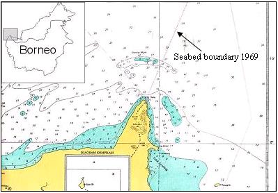
Gosong Niger: Is it Another Ambalat?

I Made Andi Arsana

It seems that cases concerning international boundaries between Indonesia and Malaysia do not stop from arising. Ambalat, the latest case causing tension built last year was apparently not the last one. While the negotiation series of the Ambalat case are even being undertaken, another issue sparks. Gosong Niger is the one that is currently becoming a hot issue, as always, in Indonesia. Not sure whether such issue is a serious concern in Malaysia.

The issue sparked when the fishing ship of West Kalimantan’s Office of Marine Affairs and Fisheries happened to be located 0.7 nautical miles from the boundary line within Malaysian territory during conducting a survey. Malaysian Navy, Tentara Laut Diraja Malaysia, suspected that this is a territorial trespassing that Indonesian ship has done. Gosong Niger lies in the border area between Indonesia and Malaysia, where the case took place. It extends over an area of some 50 sq kilometres stretching from west to east (Tempo, February 2006). The term “gosong” is apparently not a proper English. It refers to a submerged ridge of alluvial sand in shallow water, which in English is known as sandbar. See Figure 1.


Figure 1 Gosong Niger

Another issue was then discovered that Malaysian Navy usually conducts patrol around Gosong Niger and does not allow Indonesian fishermen fishing in the area. Some sources said that the traditional fishermen generally do not know that the area is under Indonesian sovereignty as they could see Malaysian ship parking in the area almost everyday. Consequently, the Indonesian fishermen have no access to the natural resources around Gosong Niger.

With respect to the existing seabed boundary between Indonesia and Malaysia 1969, Gosong Niger is part of the seabed that is divided by the boundary line where two third of the seabed fall within the Indonesian side. With regard to this, the ownership of the sandbar is considerably clear. As there is a precise line, it should have been clear who own which seabed.

However, it has to be remembered that no territorial sea boundary has been established between Indonesia and Malaysia in that area (north of Tanjung Datu). In other words the two states have agreed a seabed boundary but have not yet agreed a boundary for the water column. This means that the arrangement for sovereignty over the territorial sea in the area is not yet clear. Consequently, no judgment can be made stating that Indonesian or Malaysian ship has done territorial trespassing. However, by de facto, the existing seabed boundary is, unfortunately, recognised as the territorial sea boundary as well. This might be the reason why Indonesia or Malaysia suspects that the activities within the territorial water were boundary infringements.

As two adjacent states in Borneo Island, Indonesia and Malaysia have overlapping claim with regards to territorial sea in the area of Gosong Niger. The absence of territorial sea boundary between Indonesia and Malaysia, consequently, leaves an uncertainty regarding the sovereignty over the territorial sea (water column). If Malaysians or Indonesians go beyond the boundary line, but still in the water column without touching the seabed, they do not infringe any agreement/law. The prosecution can only be made when Indonesians or Malaysians cross the seabed boundary line and conduct activities involving seabed of Gosong Niger.

Media says that Malaysia has established a permanent tourism service around the area and provide facilities for diving, swimming, and other aqua-tourism activities around Gosong Niger. If it is true, it might worth confirming that it is not an acceptable practice as the boundary between Indonesia and Malaysia has not been agreed. If the activities involve seabed exploration or exploitation, these can be considered as infringement.

Some opinions in Indonesia said that this is similar to the case of Sipadan and Ligitan, where Malaysia will finally be granted the sovereignty over Gosong Niger because it has been demonstrating effective occupation over the sandbar. It is actually not the case. There is a permanent and agreed boundary line between Indonesia and Malaysia in Gosong Niger, but not in Celebes Sea where Pulau Sipadan and Ligitan lie. The absence of permanent boundary line in Celebes Sea, ant the lack of legal official claims were the reason why the sovereignty over the two islands were disputed. In that case, the effective occupation (Effectivités) was a relevant consideration to decide the sovereignty over Pulau Sipadan and Ligitan. In contrast, the “ownership” of Gosong Niger has been made clear by the existence of a seabed boundary agreed in 1969. The infringement conducted by either Malaysia or Indonesia has nothing to do with its sovereignty.

This case is by no mean similar with Ambalat dispute. The Ambalat dispute, being in Celebes Sea, was due to the absence of permanent seabed boundary. In contrary, the seabed boundary in Gosong Niger has been clear so there is no need to establish a new seabed boundary unlike what is required with regard to Ambalat.

It seems that international boundary disputes have been one of Indonesia’s major problems lately. Many cases regarding international boundary, sovereignty and sovereign rights have caught everybody’s attention, including Ambalat case, island ownerships/disputes, Gosong Niger, border crime, ship piracy, etc. Many suggestions have been addressed to government and corresponding bodies but it seems that the reaction has been far for acceptable. Cases keep arising. It is understandable that the government is currently struggling with other bigger and more strategic issues such as corruption and natural hazards but it does not mean that the issue regarding international boundary and sovereignty/sovereign rights can be put in the last line and treated as the least priority.

More...

Friday, February 03, 2006

My Thesis

It has been a while since my last posting.

I am reasonably busy lately with my thesis. Yes, the submission day is coming closer. I have to leave UNSW in less then two months. A flight ticket has even been booked for 28 March 2006. It is quite nervous to know that I will finally finish my thesis and leave for Indonesia.

Roughly, all chapter drafts have been written. Eight chapters were agreed to be compiled for my Master Thesis and most of them are currently corrected by Clive. Three chapters have been returned to me, even thouh none of them I have touched for revision. I am currently concentrating on checking the grammar of the last three chapters (6,7,8) before giving them to Clive for comments.

Honestly, I find it is hard to write in English. It is even worse because it is a scientific writing with all the rules of dos and don'ts. Referencing is the most important think, I believe. This is to avoid plagiarism, the one we all hate!

Btw, when started writing my thesis, I could not imagine how to write such a thick thesis with more than one hundred pages in it. Believe it or not, when you keep writing you won't realise that you have writen beyond the minimum pages you have to write. I have, so far, writen more than 135 pages, with more than 30 thousands words in it. What did I talk about in the thesis so I have written that much? Yes, that is the question I am always asking myself.

Anyway, no matter what happen, I have to finish my thesis on time. I hate having my scholarship extended! I will try hard and push myself till the limit so I don't need to extend my stay in Australia. Two years are more that enough. Not because I don't like Australia, I love being here in fact, but because I want to move on. There are still too many things to do. Indonesia is waiting for me, of that I am sure!

More...

Monday, December 19, 2005

Tension builds over Ashmore Reef: Is it Indonesia's or Australia's?

- Opinion and Editorial, December 19, 2005
I Made Andi Arsana

Ashmore reef (a.k.a. Pulau Pasir) is currently being disputed by Indonesia and Australia.

If we talk about an island/reef/islet, we are talking about sovereignty. In dealing with sovereignty we do not consider distance.

If we talk about a state authority in the sea territory, we are dealing with sovereign rights, not sovereignty. Distance becomes the key issue as it depends on the distance measured from the baseline, commonly the coastline depicting the low water line. With regards to this, it is true that we need to consider maritime zones and boundary issues. Read more...

More...

Friday, December 02, 2005

Ashmore Reef: Indonesia’s or Australia’s?

I Made Andi Arsana

In Indonesia, Ashmore reef (a.k.a. Pulau Pasir) is recently popular. The hot issue is that the reef has been disputed by Indonesia and Australia. Indonesian Navy’s Chief of Staff stated that Ashmore reef definitely is under the Australian sovereignty (Republika Online, 24 November 2005). This might be quite surprising for some Indonesians believing that Ashmore reef is Indonesia’s.

It is worth mentioning that Indonesian society should have learned much from recent cases regarding boundary and sovereignty. Reading news in the papers and electronic media, it is understandable Indonesians can be easily emotional and sometimes irrational. Legal, technical and scientific aspects are often beyond news’ concerns. Is it because Indonesians love sensation more than information?

Sovereignty vs. Sovereign Rights
If we talk about an island/reef/islet, we are talking about sovereignty. Dealing with sovereignty means we do not consider distance. The statement of Mr. Tanoni regarding the status of Ashmore Reef conflicted with Indonesian Exclusive Economic Zone (EEZ) is indeed not quite right. (Republika Online, 23 March 2003) Just because a reef lies within Indonesian EEZ, it does not necessarily mean that it belongs to Indonesia.

If we talk about State authority in the sea territory, we are dealing with sovereign rights, not sovereignty. Distance becomes the key issue as it depends on distance measured from baseline, commonly coast line depicting the low water line. With regards to this, it is true that we need to consider maritime zone and boundary issues governed by the United Nations Convention on the Law of the Sea (UNCLOS).

Ashmore: Whose Reef Is It Anyway?
The sovereignty over a reef cannot be carelessly decided. It is not depending on its distance to a State’s main land. It deals with legal aspect.

A website in the Netherlands reveals that Ashmore reef was annexed by Britain in 1878. Together with Cartier Island, Ashmore was transferred to Australia on 23 July 1931 and is then part of the Northern Territory of Australia (1938–1978). In 1978 Australia established Ashmore and Cartier Islands Territory and finally Australian government formed Ashmore Reef National Natural Reserves on 16 Augustus 1983. Of course we do not nave to trust the internet site. More intensive studies need to carry on.

CIA website, one of the resources people may trust, reveals similar facts. CIA’s World Fact Book confirms that Ashmore reef is under the Australian sovereignty. Another support also comes from GEsource website in the UK.

By plotting the coordinates of Ashmore Reef (12° 13.98' S, 123° 4.98' E) in the Indonesia-Australia EEZ boundary map, it is clear that Ashmore Reef lies within the Australian EEZ. This, implicitly, implies that Indonesia has acknowledged the Australian sovereignty over the reef.

From a historic point of view, it is true that the ancestors of Timor people came to Ashmore Reef since 1630s. However, Rais (2005) asserts that the Netherlands never secured the reef in its colonial territory and the government administering the reef was Britain. Indonesia could not claim Ashmore Reef just because their ancestors came there, did economic activities and died in the reef provided that the government administering the reef was not its predecessor (the Netherlands). In their article in Kompas (11 April 2005) Prof. Jacub Rais and J.P. Tamtomo assert that the Indonesian Proclamation of Independence secured all the former areas of the Netherlands (not others) as people in those areas had the same experience during colonialism.

It is indeed ironic that Indonesians (Timorese and others) who have been visiting and carrying activities in Ashmore Reef for hundreds of years (Kompas, 28 May 2005) are not entitled to own the Reef, while Britain (Australia), who “discovered” Ashmore in the nineteenth century, secures stronger rights. It is worth noting that modern law emphasizes legal claim rather than visits and activities. If it is true that Britain legally claimed and administered Ashmore Reef and the Netherlands did not protest, its sovereignty will obviously be Australia’s.

By contrast, Ferdi Tanoni states that there are strong evidences that Ashmore Reef were part of the Netherlands during the colonial era. He asserts that the implementation a regulation regarding sea cucumber and other marine biota collection around Ashmore Reef is a convincing evidence for its claim over the Reef. Unfortunately he did not specifically mention the document he referred. However, it this is true, it could possibly invalidate British Claim over the Reef in the eighteenth century.

Agreements between Indonesia and Australia
In 1971/1972, Indonesia and Australia agreed Continental Shelf (CS) boundary (seabed) where the boundary line located far North, close to the island of Timor (Indonesia). Some experts opined that it is not an equitable boundary. Apart from the unfairness and the failure of Indonesian diplomacy in the past, it is worth understanding that the agreement was signed before the UNCLOS came into force. Therefore, the quality of the agreement could not be judged using UNCLOS.

The Australian argument emphasized the principle of natural prolongation. The data available at that time suggested that the natural break of the Australian continent and Indonesian continent exists close to Timor Island, so that the CS boundary lies far from the median line favoring Australia. This practice was supported by legal development at that time. The ICJ’s judgment on 20 February 1969 regarding The North Sea CS case between Germany and Denmark, for instance, significantly considered geomorphology of the seabed or the principle of natural prolongation. In other words, Australian argument was supported by jurisprudence. However, the development post-UNCLOS tends to consider seabed geomorphology less. In the case of Libya and Malta (1985), for example, the ICJ decided that within 200 nautical miles, seabed geomorphology is irrelevant and the court’s judgment was based on distance principle.

It might be true that the CS boundary between Indonesia and Australia is inequitable. However, it is worth noting that the decision was with regards to the positive law applicable at that time. If required, Indonesia may renegotiate the boundary with Australia, provided that Australia agrees to do so. However, it is most likely that Australia does not want renegotiation.

Another agreement requiring attention is the 1997 EEZ boundary. Unlike the CS boundary, this is much more equitable as the border lies in the median line between the two States. Unfortunately, Indonesia has not yet ratified the agreement in its internal law.

Regarding Ashmore Reef, there is an MoU in 1974/75 allowing Indonesian traditional fishermen fishing around Ashmore Reef. Surprisingly (to Indonesia) Australia, in 2002/2003, restricted Indonesian fishermen from fishing in the area due to environmental conservation. This must attract the attention of Indonesian government and it should responsively clarify this as this endangers Indonesian fishermen’s life.

The Last Words
Undoubtedly, it is Indonesians obligation to keep the archipelago exists and united. However, clear understanding regarding legal, technical and scientific aspects are essential. Everybody should carefully analyze and be more critical toward every single issue regarding border conflict. A wrong decision may lead Indonesia to a huge material loss as well as reputation degradation as it might be considered as an emotional and irrational society.

The available legal evidences, so far, tend to suggest that Ashmore Reef is under the Australian sovereignty. However opinions and arguements sugesting that it is part of Indonesian Territory is worth to seriously consider. Let’s do our parts and let the governments do their best to achieve the most equitable solution for both sides.

More...