

It has been so long since my last posting about my research (read: my thesis). I have been spending so much time to play with other issues including Ambalat. However, it is an important moment for my academic career path!
So, it is the time to get back to Timor Leste issue.
Data
I have collected data from Bakosurtanal and Dishidros but unfortunately none of the data is in vector format. Bakosurtanal gave the nautical chart of Timor Island in Adobe Illustrator format that is convertable into TIFF. In my hand now are some files in TIFF depicting Timor Island in some different sheets.
Image Registration
In order to be able to process the data using CARIS LOTS, it has to be geo-registered. This is a standard proces in dealing with image data that has not yet geo-referenced.
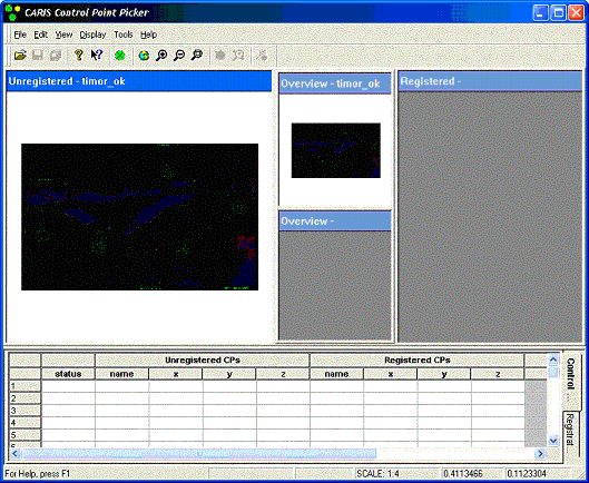
Good news, CARIS is equipped with that kind of function so, this can be ,theoritically, done easily. However the actual process has never been as simple as the plan. The TIFF image after being imported into CARIS did not appear clearly so it was really difficult (if not impossible) to process the registration. How could you pick the common control points if you can't even see the image clearly? The only thing shown was a black image illustrated bellow.
What to do next?
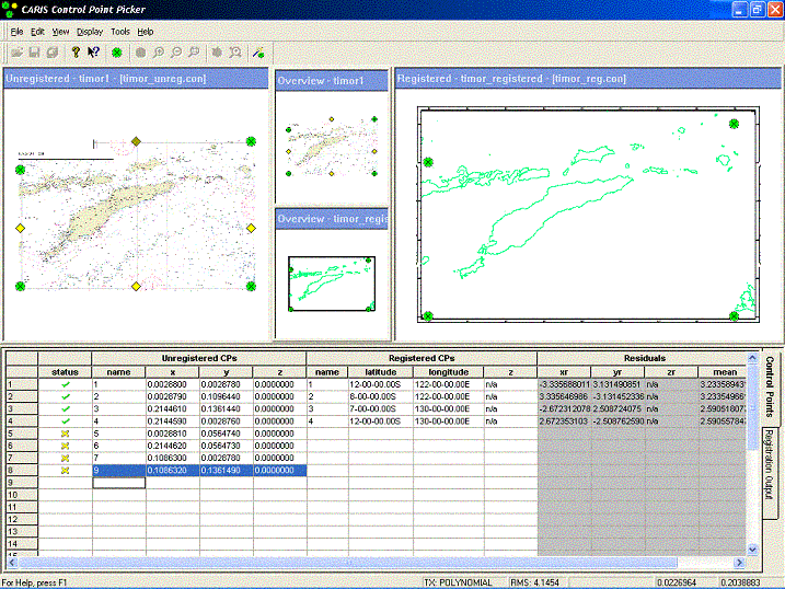
After googling for days and trying many possibilities, I finally came up with a solution. There was something to do with the compression. The image has to be compressed using LZW & Differencing. I did it using Microsoft Photo Editor. Thanks to Uncle Bill Gates! :) The image could then be easily imported into CARIS to be registered. The next process are to define the basepoints and simulate the boundary line possibilities.
Have you had a similar experince with registration? Try this!

No comments:
Post a Comment