

I Made Andi Arsana2
Introduction
This is prepared for a short session in a workshop covering the material about dispute resolution related to international maritime boundaries. It is designed to be a general introduction since the available time is not longer than 1.25 hour.
Instead of providing detail steps on how to operate CARIS LOTS™, this will focus on some relevant technical issues in delimiting maritime boundaries and resolving potential emerging conflict. To give better technical understanding, a demo of using CARIS LOTS™ will be presented.
This includes: knowing CARIS LOTS™ interface, Basic Operation, CARIS LOTS™ existing data, dealing with Vector and Raster Data, baseline and basepoint construction, robust median line construction, weighting, and finalization.
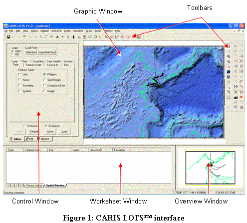
1. CARIS LOTS™ Interface:
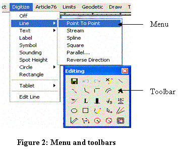
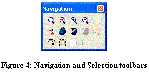
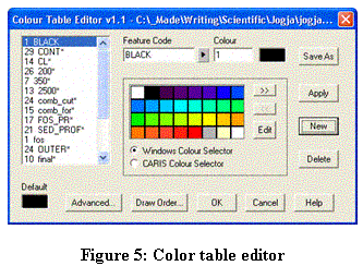
2. Basic Operations
Basically CARIS LOTS™ employs the same operational procedure as other windows-based GIS software. It is not very difficult to understand basic operation such as:
a. Switching between menu and toolbar command
b. Open and closing map [file >> open]

c. Navigation (zoom, pan, scroll) and Selection (single, multiple, all)
d. Color setting [Tools >> Colours…]
e. Set Filter (viewing only desired feature[s])

3. CARIS LOTS™ existing data (Caris Digital Atlas, CDA)
By default, CARIS comes with three kinds of high resolution data that can be used to exercise maritime claims. The three types of data are:
a. Global Seafloor Topography from satellite altimetry (2-minute bathymetric data, covering 72°N to 72°S with 50,000,000 soundings.
b. Etopo2 data has complete global coverage with bathymetry data coverage of 60,000,000 soundings and land cover of 20,000,000 spot heights.
c. The World Vector Shoreline (WVS) at a nominal scale of 1:250000, contains shorelines, international boundaries, and country names of the world.
Maritime Boundary Delimitation and Dispute Resolution: A Scenario
States in disputes are simulated as three States in a neighborhood: A, B, and C (see figure 1 bellow). States A and B are adjacent and C is opposite to both A and B. State B owns Island P that situates between State B and State C. Between State A and B, an adjacent maritime boundary has to be delimited , which is quite straight forward. Both state A and B use normal baseline. Meanwhile State C has fringing islands and irregular shape of coastal line. It has to employ combined baselines: normal and straight baseline. In delimiting maritime boundary between C and B, Island P has to be considered. The island can be given zero effect, half effect or full effect, which depends on relevant factors considered. Each scenario will generate different composition of boundary line.
In delimiting maritime boundary between A and C, an oil-rich block between them has to be considered. Based on negotiation, both states agree to have a joint-development area. This causes a gap that breaks the boundary line between State A and C.
1. Nautical Chart

Chart can be imported from the CARIS existing data or obtained locally from an authorized body (for Indonesia: Bakosurtanal, Dishidros). It is also possible to import from shape file (ESRI file), ASCII, or geo-referenced raster data. CARIS LOTS™ is also equipped with geo-referencing feature for a non-geo-referenced raster data (e.g. TIFF -> GEOTIFF).
2. Normal Baseline, Straight Baseline
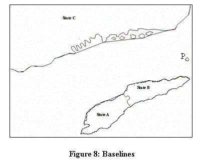
There are two types of baselines demonstrated above. For state A and B, normal baselines -the line depicting low water line- are used. For state C, combinations of normal baseline and straight baseline are used. Straight baselines need to be employed because of the condition of its coast line. Some part of coast line is deeply cut into while some part is fringed with islets.
3. Robust Median Line Construction
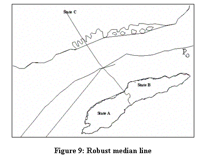
An equidistant line is generated between state A and B heading north. The generation of median line between States A and State C has not yet considered JDA. Similarly, State B-State C median line has not either considered Island P.
4. Weighting
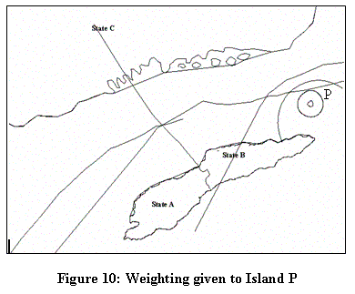
Different weight assigned to Island P produces different combination of median line. The above figure shows three different weights/effects given to Island P: zero effect, half effect and full effect.
5. Finalization
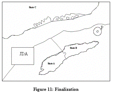
Joint Development Area is added between State A and C causing a break in the median line. Between State B and C, the line agreed is the one giving half effect to the Island P. Final line is to be achieved by mutual bilateral agreement among/between states in question.
Footnotes
1Presented in a workshop organized by Bakosurtanal-FT UGM, Yogyakarta, 6-7 May 2005
2 Lecturer in the Department of Geodetic Enginering, a researcher in the Center for Boundary Studies Bakosurtanal-FT UGM, currently pursuing postgraduate research study in the University of New South Wales, Sydney madeandi@ugm.ac.id

No comments:
Post a Comment